
A three-day weekend is the perfect opportunity to go hiking in the United States. After having done mont Gothics a few weeks ago. This time, we decided to head for Mount Lafayette in the Whites Mountains. We chose to do the beautiful Franconia Ridge Trail loop.
It's a 13km hike with around 1200 meters of ascent. It's considered a difficult hike, mainly because of the difference in altitude.
Presentation
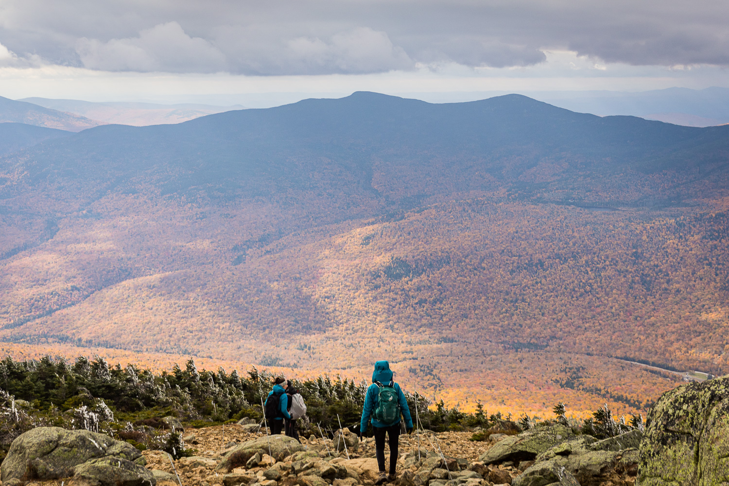
Mount Lafayette is a very popular hike. If you're looking for a place to be a bit alone in the middle of nature, I'd recommend changing your plans. If, on the other hand, you're looking for a nice hike that will take you along a beautiful ridge covering several peaks, you've made the right choice.

The most classic loop, which we did, is called the Franconia Ridge Trail. It passes over the summit of Mount Lafayette and Mount Lincoln, and offers several fine viewpoints, a traverse of a fairly wide ridge and a beautiful waterfall. Over 13 km and 1200 m ascent, the hike is sustained, but does not include any technical sections. The weather, however, can be rather capricious, as you'll see in "our experience" below.
Allow around 7 hours to complete the hike.
Practical information for Franconia Ridge Trail :
- Where: Mount Lafayette, New Hampshire, USA (about 3 h from Montreal)
- Hiking name: Mount Lafayette and Franconia Ridge Trail loop
- Length: 13km
- Difference in altitude: 1200 metres
- Duration: 7 to 8 hours for the loop
- Difficulty: Difficult, steep slopes
- Dogs allowed
The hike can be done either clockwise or anti-clockwise. We did both, and I personally didn't see much difference in difficulty. Most people say, however, that the clockwise route, which takes you past the waterfall at the start, is a little easier.
Parking:
Parking is free and easy to find. It's also quite large, but as the hike is very popular, it can be full before 9am.

Recommended equipment:
This is our second time up Mount Lafayette in autumn, and I have to say that the weather can change very quickly and be very different between the start and the summit. The section on the ridge that passes over the two summits is quite windy.
So I recommend at least a windbreaker and one or two warm layers. Especially in spring or autumn. I've never needed crampons, but if conditions are really bad, you might be glad to have them.
The usual hiking boots, water bottle and small snacks are more than recommended at all times.
Refuge:
If you'd like to do the hike over several days, or make it part of a longer loop, it's possible to sleep in the refuge. Greenleaf hut (Remember to check its opening dates, as it's not open all year round).
When it's open, and even if you don't sleep there, the refuge offers some food and toilet facilities. A nice warm break on the trail.

Our Mount Lafayette hiking experience
Hiking a week after running a marathon, during which I hurt my knees a little, isn't necessarily the best idea. I thought I'd recovered sufficiently during the week and my pain had disappeared. Unfortunately, they returned quite quickly on the climb. This didn't prevent me from finishing the hike, but it did affect my pace and the way I felt during the walk.

We had planned to leave around 8am and we were quite punctual, because at 8:02am I started the check-in on the watch. We arrived around 7:30 a.m. The parking lot was far from empty, but there was still enough room. Note that we were on a long weekend for Canada, not the USA, but the weather forecast was rather mediocre if not bad.

The forecast was right, and we soon had the first rain mixed with snow. As we climbed a little higher, we were definitely in fog and snow. We were prepared, so it wasn't really a problem.

But between the bad weather and my recurring knee pain, my motivation was severely tested. I hesitated several times to turn back. This wasn't my first time up Mount Lafayette, and even though it's a beautiful hike, I was pretty unmotivated to find myself in the fog at the summit like the first time.

Having set off in an anti-clockwise direction, we reach the hut fairly quickly and the scenery doesn't really make you want to continue. We decided to take a longer break in the warmth, hoping that the weather would improve. It turned out to be the right choice! After about 45 minutes, the clouds parted a little and we were treated to a few rays of sunshine. We set off again for the summit.
The difference in scenery between our arrival and departure from the refuge is truly striking.


We reach the summit, most of the ascent done. The trail continues from summit to summit, alternating between fog and sunshine. You have to be quick to take photos, as visibility goes from zero to zero in a matter of seconds. It's really impressive. Fortunately, the path is easy to follow.


We reach the end of the ridge and begin the descent. Most of the descent takes place in the rain until we reach the waterfall and then the parking area. We finish in the downpour. Very happy not to be camping tonight.

At this point, I'm glad I'm no longer at the summit. I imagine the people up there must be in a bit of a snowstorm, like we were at Mount Algonquin. It's rarely a pleasant situation.

With our long break at the refuge, the hike will have taken us 8h26.
For the curious, here's our route recorded with my Garmin:


